Some recent map-staring suggested a circuit linking the two main Bristol railway stations and points along the Severn Beach branch line, and the Bristol Rail Round was born. The route uses parks, paths and other off-road sections as much as possible: indeed the only streetside walking of any distance on the main circuit is the (unavoidable) tramp past Avonmouth Docks.
The main route crosses the Avon on the two high bridges, so for those without a solid head for heights, there is a low-level alternative route from Portway to Bristol Harbour: one-third of its length is another unavoidable pavement beside a busy road, in this case the A4.
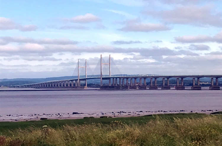
The M5 bridge may only be 30m above the water (or mud), but it is far longer and far more exposed than the 100m-high Clifton Suspension Bridge, with much less comfort of others on the bridge. Do not attempt it if you are in any way unsure of your reaction — it is far better to back down than to break down.
The route is contained within a single descriptive document: map coverage is as below.
| Bristol Temple Meads to Bristol Parkway 12.0km — 184m ascent | Map |
| Bristol Parkway to Severn Beach 15.8km — 78m ascent | Map |
| Severn Beach to Portway Park and Ride 9.0km — 3m ascent | Map |
| Portway Park and Ride to Bristol Temple Meads via Avonmouth Bridge, Clifton Suspension Bridge, and Poole’s Wharf 16.3km — 228m ascent | Map |
| Portway Park and Ride to Poole’s Wharf via Sea Mills 10.3km — 53m ascent | Map |
Disclaimer and advisory notices
Note that lwalks.london can accept no responsibility for content on an external site or in an external publication, nor for any action by an external site which renders our content or link outdated or unworkable. Furthermore, lwalks.london retains the liberty to unlink external content at any time if the content loses relevance to the linking page(s).
Images used on the lwalks.london site are either owned by lwalks.london, or are subject to a licence-to-use held by lwalks.london. These images must not be further used by any third party without the explicit permission of lwalks.london, or of the original image licensor. A small number of images are in the public domain.
Routes are to be followed entirely at the walker’s own risk: lwalks.london can take no responsibility for any inconvenience, damage, loss or injury caused by attempting to follow a route, which is no more than a mere suggestion of a possible enterprise.
We should be happy to learn of any changes to the line of a walk and/or its attendant facilities, or to consider an image which you own for inclusion on the site, lwalks.london thus being granted a free and non-exclusive licence to use the image anywhere on its site. Please contact us.
