Now that the first sector of my proposed walk around the termini of my London radial walks (from Southend to Epping) is complete, the most recent day having done double duty with the final instalment of the Essex Way, I was looking round for another walk. Since the circumcardinal route‘s next sector follows the Lea Valley Walk from Cheshunt to Hatfield, it seemed a good idea to fill in the section from the Thames to Cheshunt.
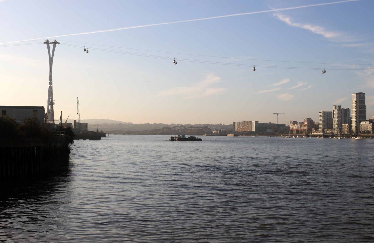
I arrived at Canning Town Tube station at 0745 on a bright September morning, and set off for Trinity Buoy Wharf, where the River Lea empties into the Thames. The area they call City Island (it is not: it is merely part of a peninsula) is a soulless bundle of antiseptic flats, the architectural equivalent of a bottle of hand-sanitiser, and this reformulation will seep under the elevated roadway to colonise Trinity Buoy Wharf and erase as much history as it can get away with.
The mouth of the river is opposite the Dome, which looks curiously flat from across the river: there is the lighthouse and an old lightship amongst the recent encrustations. So, back under the road and turn left, only to find the way gated and locked. Another alleged access was boarded off, so there was no alternative but to traverse the dystopian City Island and return to Canning Town. Down to the Tube, through the station, up to the bus station, cross the A13, and make for Star Lane DLR station along the dilapidation and litter of Stephenson Street. Turn left, and left again at the coffee roasters, across the bridge at Cody Wharf, and at last I was walking along the river.

And that was the story of the next three hours. I picked up the Lee Navigation at Bow Locks, and left for the day at Ponders End — appropriately, because the slowly evolving linear landscape was good for pondering. Except, of course, at such pinch-points as the approach to the North Circular, where the path narrows to be just about wide enough for two non-obese walkers to pass, and nowhere near safe enough for a walker/cyclist meeting.

By Ponders End, there was a gratifying increase in the semi-rural, which bodes well for the next section. However, it must be noted that the hard surface (whether tarmac, paving slabs, or just the compaction of the towpath down the centuries) begins to jar on the legs: I used calculations of probable stages ahead to justify leaving for lunch when I did.
